 Tip: Are you a non-native English speaker? I have just finished creating a
  Web App
The map below is based on data by the European Space Agency (the CCI project). It shows North America with colouring representing various types of land cover (such as forests, cropland, water, etc.). Shading (darker areas) represents elevation (mountains).
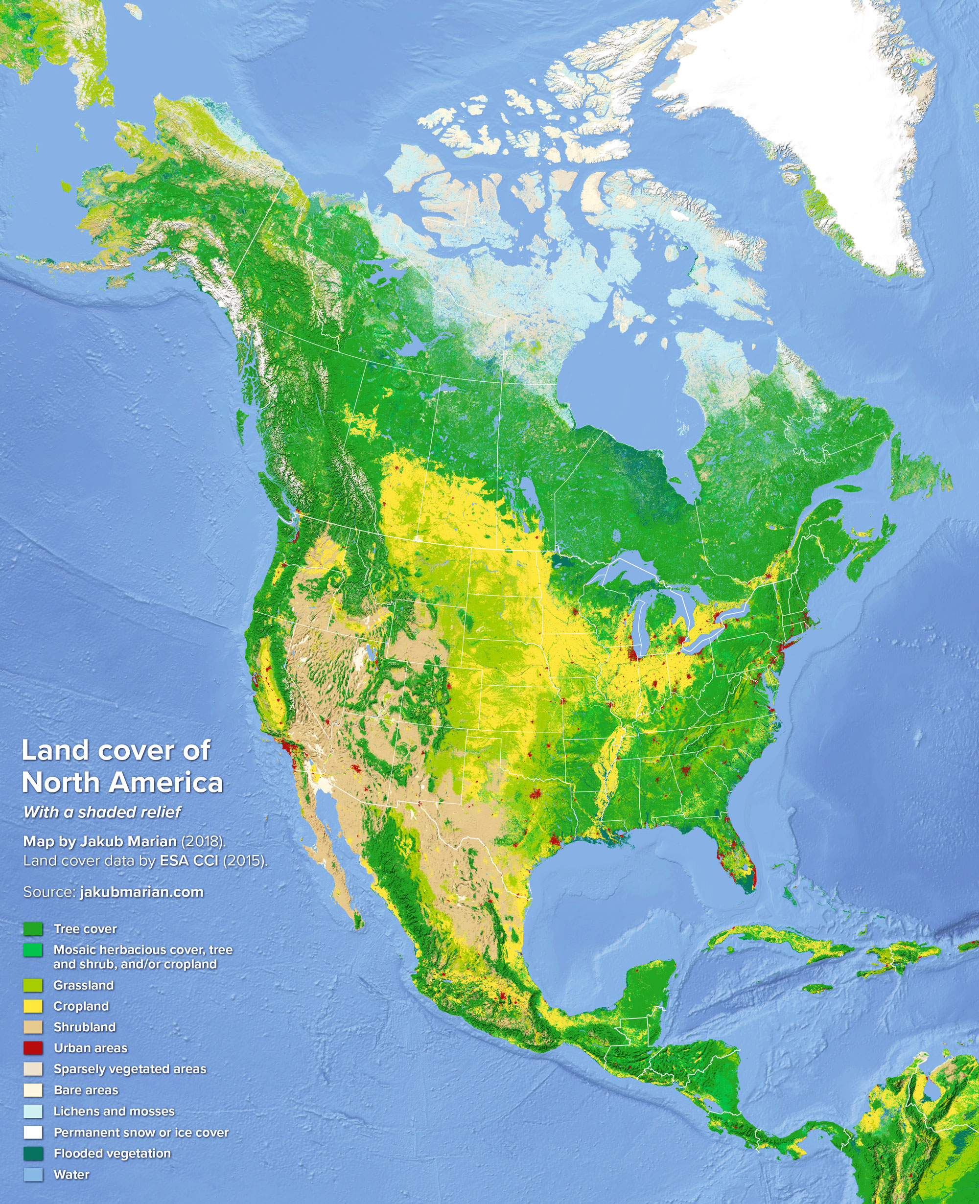
There are some noticeable differences between this map and its European counterpart. European land cover is highly mixed, with many patches of cropland, grassland, and forest resulting from thousands of years of deforestation, land-use planning, and reforestation, whereas North America is visibly divided into several “zones”.
Another distinguishing feature is the vast area of shrubland, which is almost non-existent in Europe, and also the presence of completely bare areas (the Sevier Desert in Utah and El Pinacate y Gran Desierto in northern Mexico).

