 Tip: Are you a non-native English speaker? I have just finished creating a
  Web App
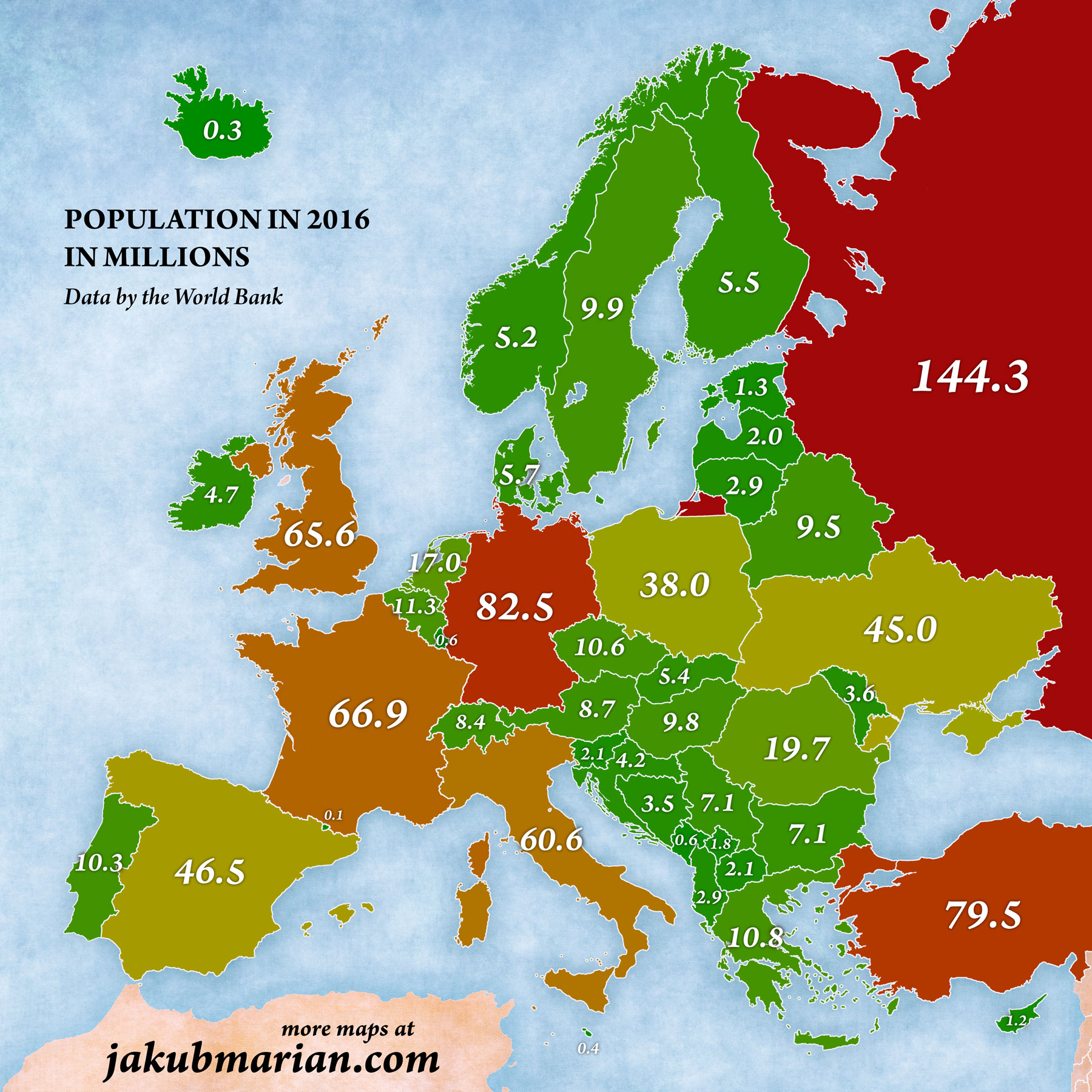
The map below shows the population of European countries in millions, based on data by the World Bank from 2016. Please note that high numbers are represented by red colour, which is common in population statistics and does not in any way indicate whether having a large population is “good” or “bad”.
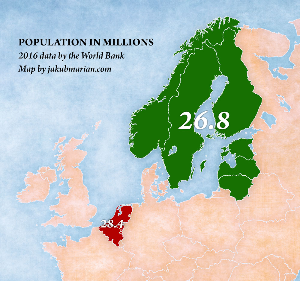
It is clear that some countries are much more densely populated than others. The Nordic countries and the Baltic states have the lowest population density in Europe, and the Netherlands and Belgium have the highest density. In fact, the two regions shown on the map below have a similar population, with the larger region still being less populated:
Another comparison I find quite interesting from a linguistic point of view is that of Germany and the Balkan states and surrounding countries (which also have a fairly low population density):

Every country in the green region has its own language (or standardized variety of a language), except Moldova and Kosovo. Being able to communicate with the same number of people in the green region as German allows you in a single country would require learning at least 8 different languages from 5 different language (sub)families.

