 Tip: Are you a non-native English speaker? I have just finished creating a
  Web App
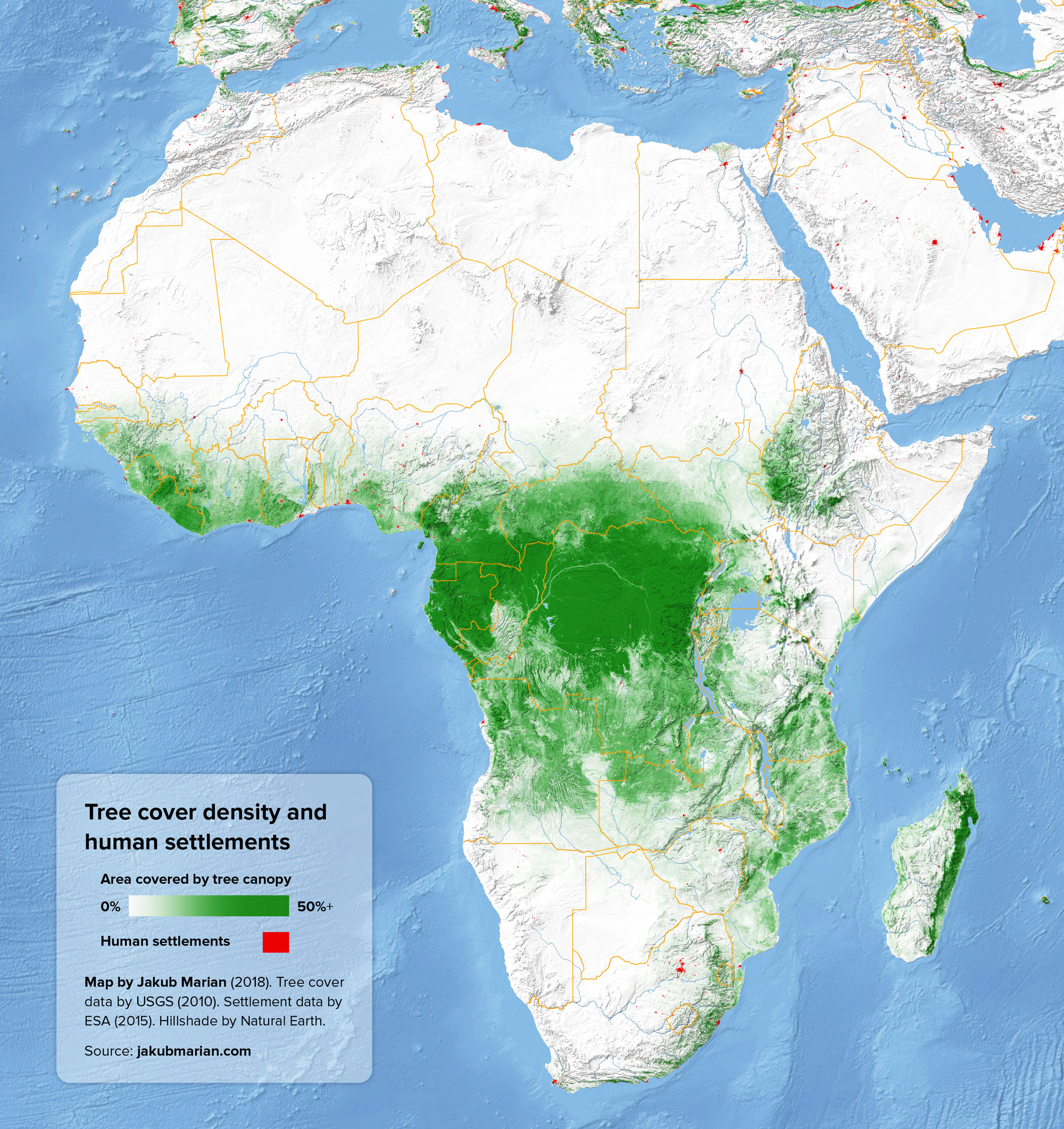
The map below shows the percentage of land covered by tree canopy (based on data by the U.S. Geological Survey from 2010) together with man-made structures (in red, based on data by ESA). Areas that are neither red nor green represent other types of land cover, such as crops, grass, shrubs, bare rocks, and water:
Do you like the map? Show your support by sharing it.Sharing with attribution helps me create more maps.
It should be noted that the sharp edges visible in the Central African Republic and South Sudan are likely just the result of a combination of two different sources of satellite imagery, perhaps taken during different seasons, rather than a representation of real natural features.

