 Tip: Are you a non-native English speaker? I have just finished creating a
  Web App
The map below shows the percentage of land covered by tree canopy (based on data by the U.S. Geological Survey from 2010) together with man-made structures (represented by red colour, based on data by ESA). Areas that are neither red nor green represent other types of land cover, such as crops, grass, shrubs, bare rocks, and water.
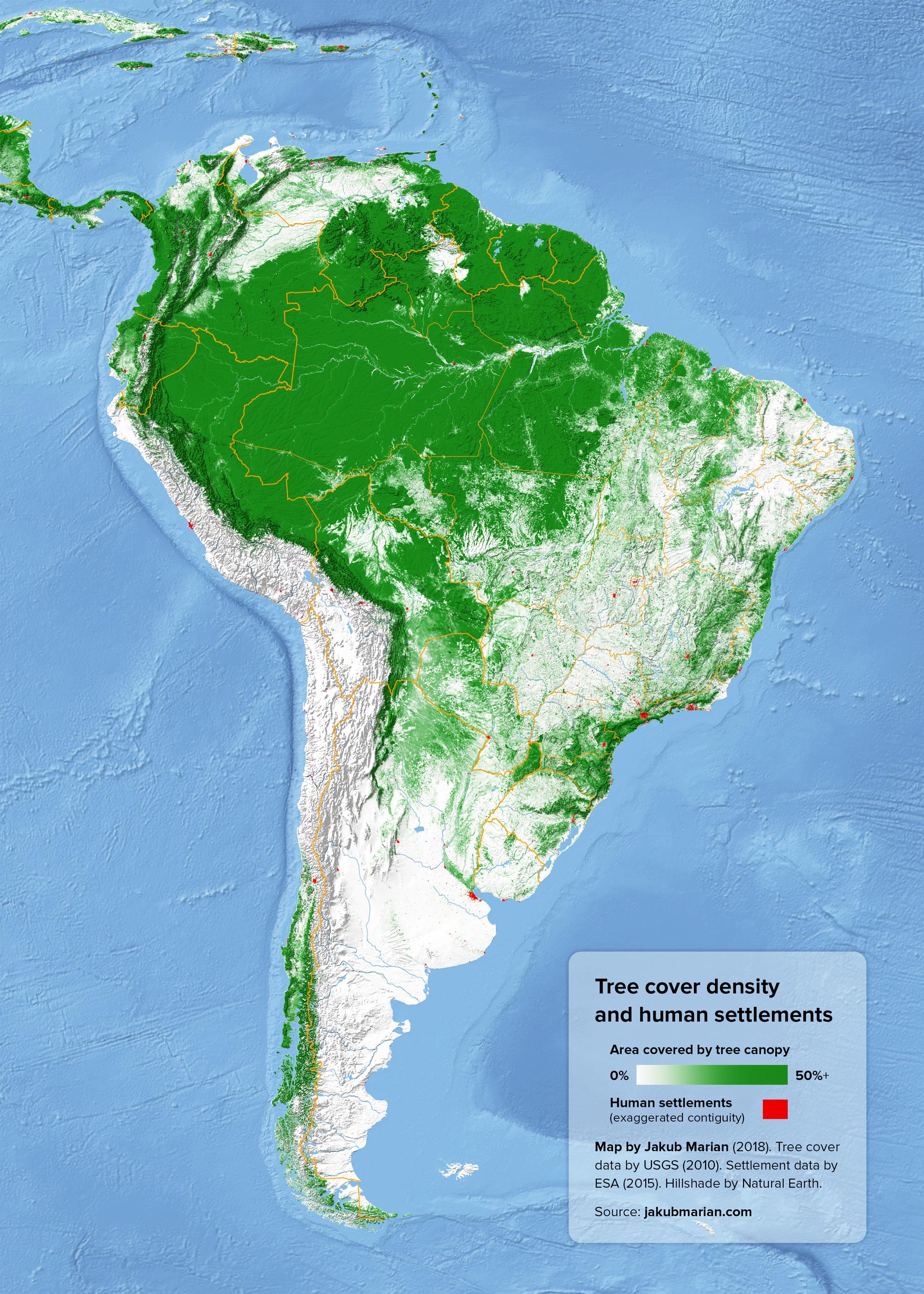
One important feature to notice is a large number of white and bright green areas between patches of dark green in the Brazilian states of Acre, Rondônia, Mato Grosso, and Pará. These areas appeared as the result of ongoing deforestation (they were nearly completely covered with tropical rainforest a hundred years ago, and, according to FAO, around 20% of the Amazonian forest has been lost since 1970).
Since the deforestation continues to this day (albeit at a slower pace) and the map is based on data from 2010, the real extent of deforested areas is somewhat larger than the one shown on the map.

