 Tip: Are you a non-native English speaker? I have just finished creating a
  Web App
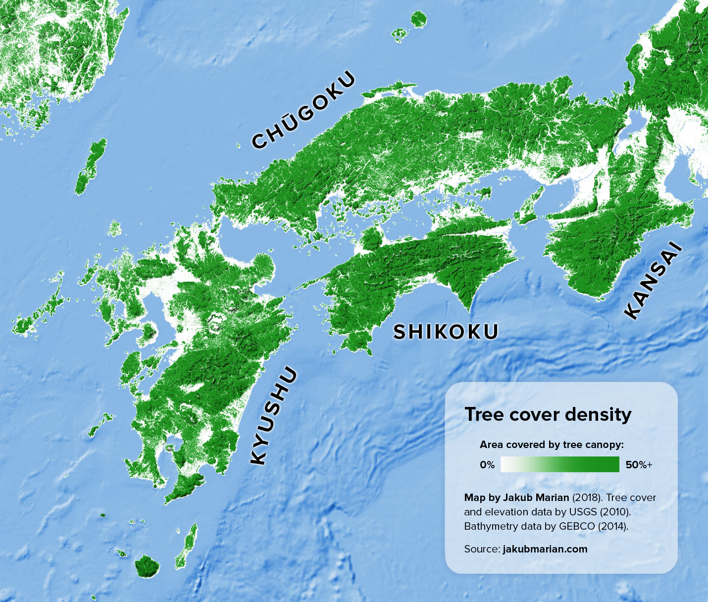
The map below shows the percentage of land covered by tree canopy (based on data by the U.S. Geological Survey from 2010) together with a shaded relief representing elevation (also based on data by the USGS) on the Japanese islands Kyushu and Shikoku and in the regions Chugoku and Kansai of the island Honshu.
It is part of my larger map of the region of Japan and the Korean Peninsula.
Do you like the map? Show your support by sharing it.Sharing with attribution helps me create more maps.

