 Tip: Are you a non-native English speaker? I have just finished creating a
  Web App
The Eastern Alps are part of the Alps, the highest and most extensive mountain range system in Europe. The Eastern Alps include parts of Italy, Austria, Switzerland, Germany (Bavaria), Slovenia, and Liechtenstein.
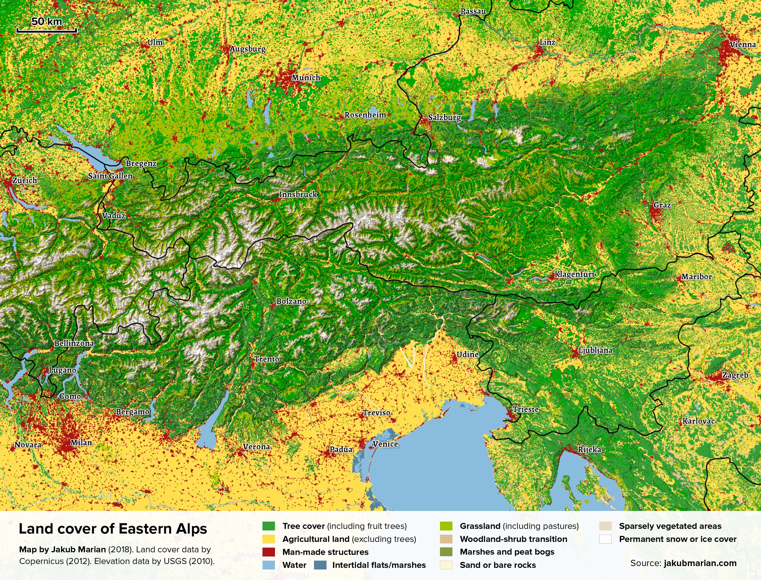
The map below is based on data by the Copernicus Land Monitoring Service (CORINE 2012). It shows the Eastern Alps with colouring representing various types of land cover (such as forests, agricultural land, water, etc.). I have also made a corresponding map of the Western Alps.
There are several interesting features to notice that may not be obvious from a typical map:
- The Bavarian Alps are separated from the rest of Germany by a strip of land (around 50 km wide) consisting of villages completely surrounded by meadows and small forests, which is a rather unusual configuration.
- The river-shaped sand areas in the northeast of Italy are so-called braided rivers, which are usually incorrectly shown on maps as ordinary rivers.
Do you like the map? Show your support by sharing it.Sharing with attribution helps me create more maps.

