 Tip: Are you a non-native English speaker? I have just finished creating a
  Web App
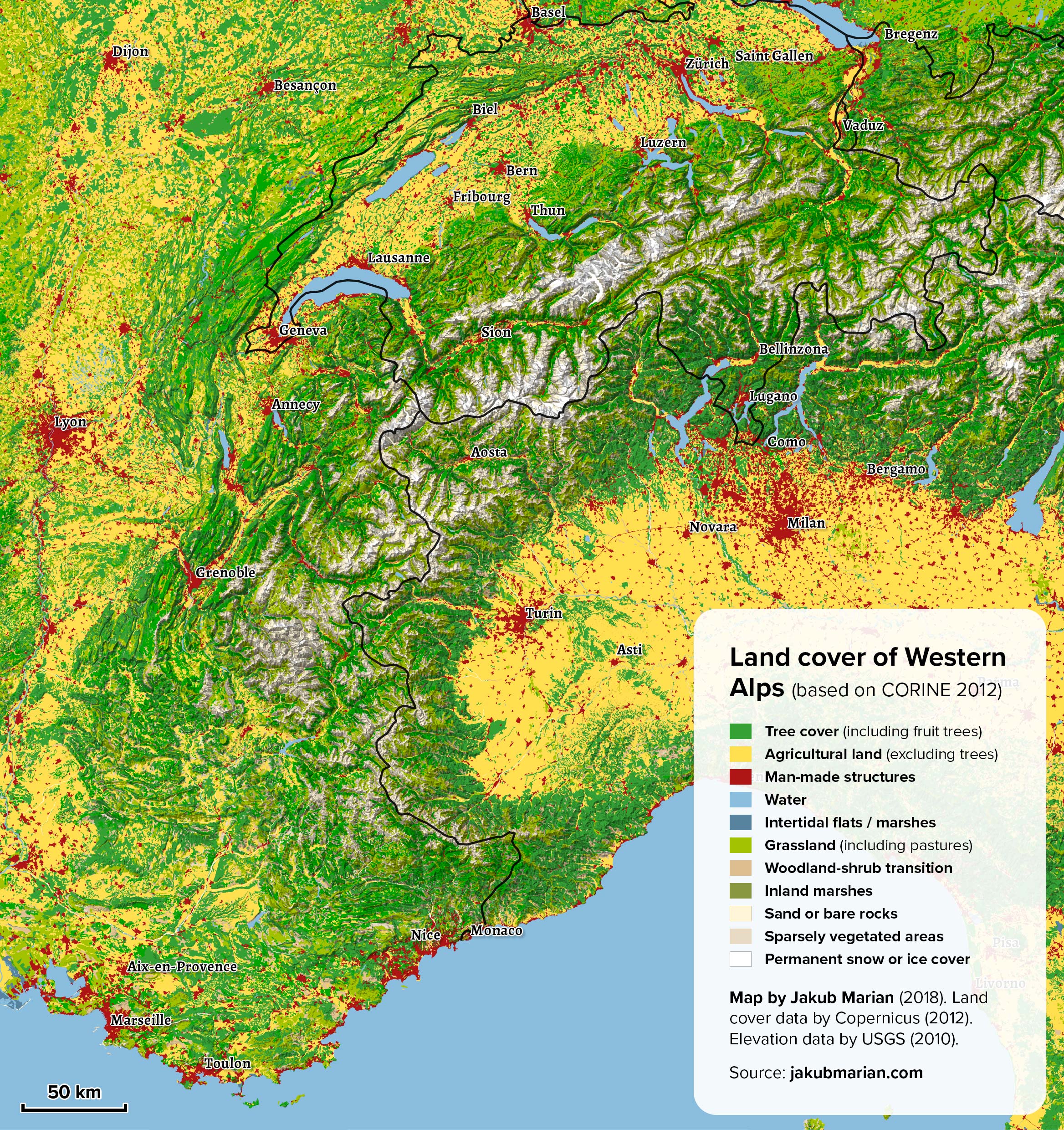
The Western Alps are part of the Alps, the highest and most extensive mountain range system in Europe. The Western Alps include parts of France, Italy, and Switzerland, and, depending on the definition, possibly also Austria and Liechtenstein.
The map below is based on data by the Copernicus Land Monitoring Service (CORINE 2012). It shows the Western Alps with colouring representing various types of land cover (such as forests, agricultural land, water, etc.). I have also made a corresponding map of the Eastern Alps.
Do you like the map? Show your support by sharing it.Sharing with attribution helps me create more maps.

