 Tip: Are you a non-native English speaker? I have just finished creating a
  Web App
The map below shows the tree cover and human settlements in East, South and Southeast Asia, which include, among others, China, India, Indonesia, and Japan. Parts of Russia are also shown.
Four main types of forest can be seen on the map. Tropical forests cover most of Southeast Asia, and more sparsely also central and southern India. The south of China is covered by subtropical forests, whereas Nepal, the Himalayan region of India, the north of China, Korea, and Japan are covered by temperate forests. In the uppermost part of the map, we can see the taiga (also called “boreal forest”).
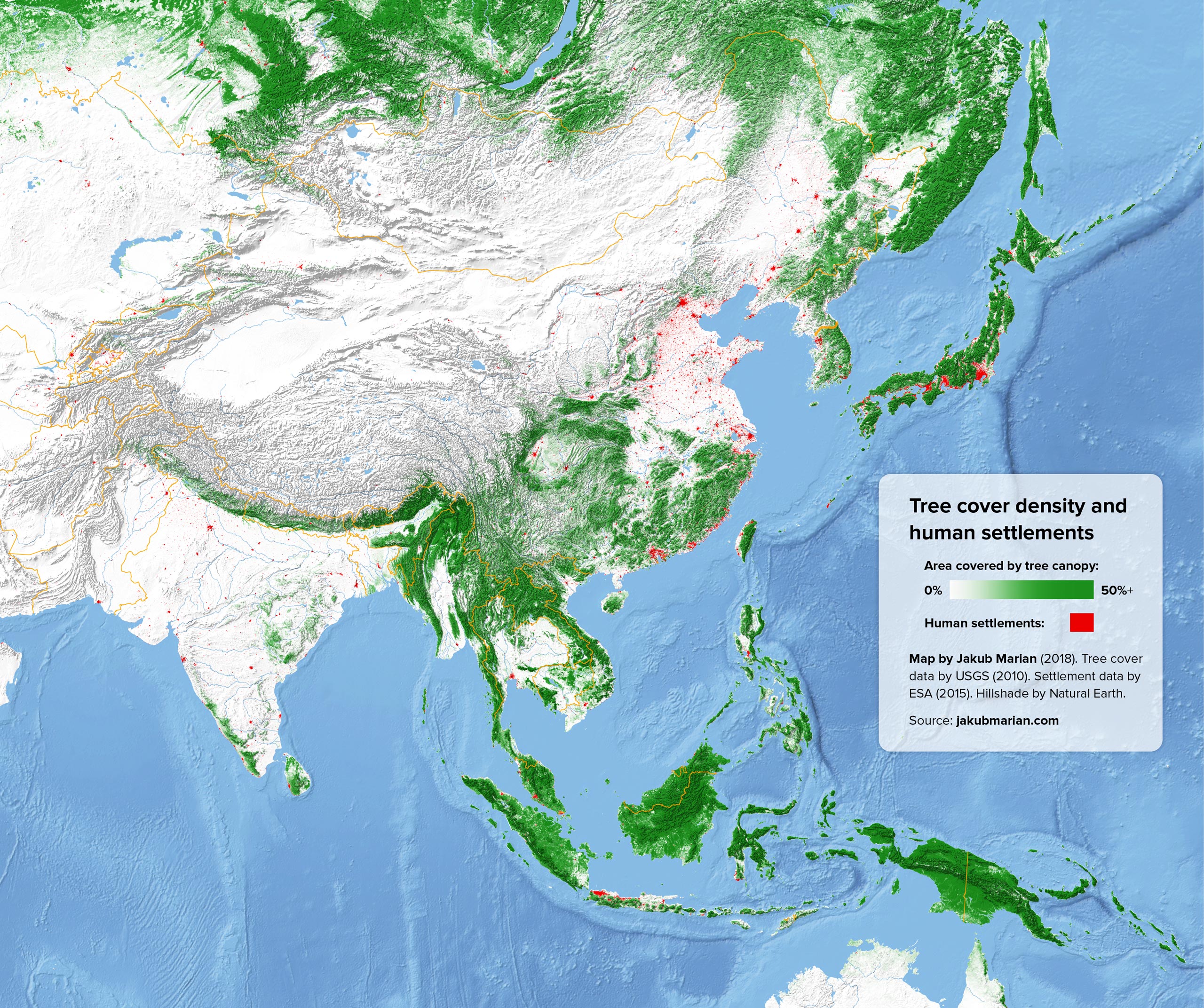
A note of caution is in order here. India seems to be much less densely populated than China on the map, but, in fact, it has nearly the same population size. The reason is that the majority of Indians live in villages that are too small to be visible on the map (smaller than one pixel), whereas the Chinese are more concentrated in towns and cities that are large enough to be visible. Statistically speaking, around 56% of the population of China is urban, while just 33% of Indians live in urban areas.

